Occasional claps of thunder could be heard and flashes of lightning illuminated the dark, brooding hills. I was in trouble and knew it. I had started from Sundarijal (around 1,400 meters) on the northern outskirts of Kathmandu at around two in the afternoon. It was early October, and the monsoon should have stopped bringing fine trekking weather to the hills. The guidebooks told me that there were lodges at Burlang Bhanjyang about two and half hours from Sundarijal. After a long, tiring climb up the ridge trail, however, the lodges were conspicuous by their absence. And the constant drizzle only added to my concern and my misery.
By now it was after4:30 pm. The villagers I met advised me to continue on to Chisapani about one hour away. (Given the weather, Chisapani/Chisopani means, appropriately, ‘cold water’) The trail continued climbing and the light was fading. At 5:30 I had to stop as it was nearly dark and I could no longer see the difficult and slippery trail. I was totally alone in the jungle. I thought I might trek on in the dark using my headlamp and frantically searched for it in my back pack. It wasn’t there... I must have left it behind. But I had my raincoat and a water proof cover for my bag. One option was to bivouac by the side of the trail, but the rain was coming down heavier and I was depressed thinking of the long wet night ahead.
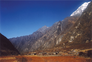
On the way from Langtang village towards Kyangjin Gompa
Suddenly I saw a light flash off in the forest. It steadily drew nearer until it reached me in the hands of a man walking in the dark to Chisapani. He told me that the village was less than 10 minutes away and asked me to accompany him. The path was slippery and muddy because of the rains, but after about 10 minutes we came to the lodges of Chisapani (at an altitude of around 2,200 m). I was immensely relieved and could have hugged my benefactor. Instead, I restrained myself and invited him to join me for a cup of tea. He said he still had a long way to go to his home, however, and must continue as the hour was late.
After checking into the lodge, it was a relief to change into dry clothes and drink something warm. Outside, the rain continued throughout the night.
ON THE TRAIL TO CHIPLING
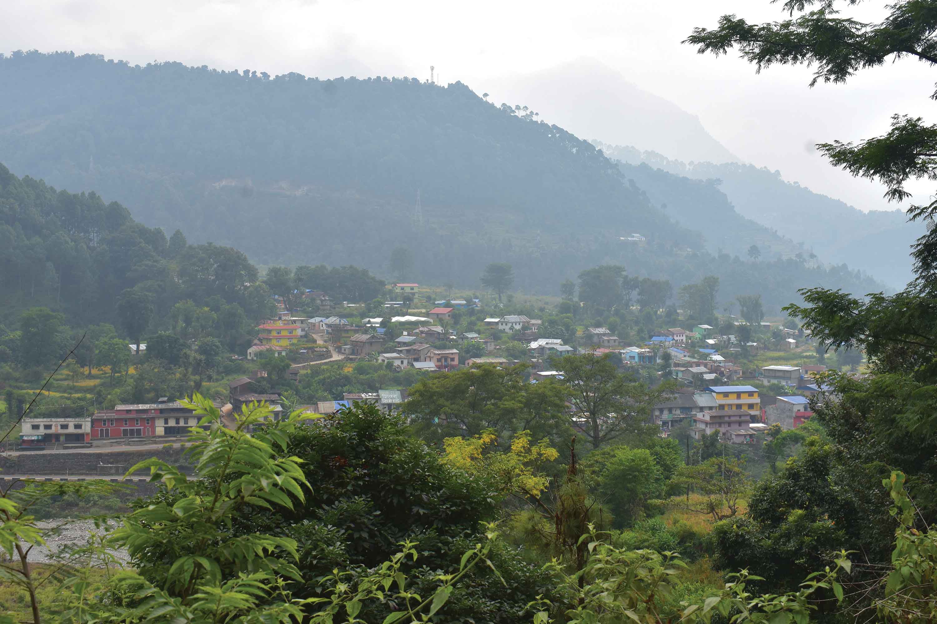
Next morning, after an early breakfast of muesli and milk, I started on towards the village of Chipling. Rough motorable roads are now making steady progress into the hills and the early part of that day’s trek was along one such unpaved track. The rains had caused landslides in places and only a few trekkers were on the road. Gradually the trail started narrowing and eventually disappeared. I retraced my steps to a hamlet and enquired about the path to Chipling. The farmer said that that I had to climb uphill by a path that diverted from the road. A German gentleman joined me and said he was on his way to join his friends who were staying at Tharepati. The trail along a steep ravine as slippery and I was disheartened with both the weather and the trail. The German gave me courage: “It is a hard way but it is my way,” he said, and continued uphill. I met a lodge owner on the way who was carrying provisions to Chipling. He invited me to walk with him, but even with his load he was too quick for me and we soon parted company.
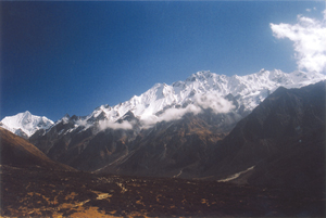
Magnificent view of the Himals on the way to Langtang village
Chipling is a small village with two or three lodges. The use of solar electricity for lighting was very much in evidence. I stopped briefly for tea and snacks before continuing on. By now, the sky was darkening again and clouds were playing tag with the trees on the hillside. At about 4 o’clock, I finally reached the spread-out village of Gulphu Bhanjyang at 2,200 meters (a bhanjyang meaning a pass in Nepali). The trail had been uphill and down, and despite all the physical exertion I had not gained in altitude over Chisapani.
At Chipling I found a nice lodge with a small shrine in front and decided to stay the night there. I was given a room in the older section of the house. The dining hall was gaily decorated, and the people who ran it were Tamang. A Buddhist religious ceremony was in progress, but it ended soon after I arrived. A Dane and his son soon checked in. The father told me he was an engineer and that his son worked in the Danish Central Bank. They were doing the Helambu circuit, and over the next few days, our paths often intertwined.
That evening, the clouds enveloped the lodge in their cold embrace. The rain continued. And the power failed. I slept listening to the drizzle outside my window.
The next morning was reasonably clear when I set out. I’d had a hearty breakfast cooked by a pleasant lady in her twenties. It wasn’t long, however, when – you guessed it – the clouds rolled in and it was soon raining. What a way to trek I thought. Not very pleasant. At Khutumsang (around 2,500 meters in altitude), I stopped for tea at a beautiful new lodge and, as it seemed a good place to stay, I stopped for the day. I was assured that on a clear day there was a nice view. All I could see were clouds.
IN THE HIGH PASTURES
Mangengoth, at 3,285 meters, was my next destination, a long way ahead. A goth (as in Mangengoth) is a temporary shelter for shepherds, so it didn’t sound very promising. The trail led me steadily uphill. The air was, by now, quite chilly, and a steady rain added to my woes. The forest of oak and rhododendron was dark and gloomy. I arrived there late in the afternoon, well after 4 pm, and found a lodge. It was not luxurious but the owners were friendly. Given the cold and the wet, and gladly I spent the evening in the kitchen in front of a roaring fire. My Danish acquaintances of the previous evening had also arrived, and there was also a big group of vivacious and energetic middle-aged Israeli ladies. Their guide was a good chap, so we chatted about Helambu and trekking in general. He had led treks in various regions and knew this route well. He suggested that I stay the following day at Tharepati, where I could enjoy the early morning mountain views – if the weather was clear. A lodge owner from Tharepati was also ‘overnighting’ in our Mangengoth lodge and invited us all to stay in his lodge.
After starting out in the morning, I could see the few lodges of Tharepati at the top of a densely forested hill. I reached them shortly before noon after a steep climb that gave my legs and lungs a good workout. My new-found lodge owner friend gave me a room adjoining the dining hall. Soon, the Israeli ladies and their guide arrived, but the Danish pair had gone on to the large Sherpa village of Melamchighyang to spend the night. While clouds still shrouded the distant summits from view, the weather, at least, was sunny. Along the trail, I had seen the bare stone walls of highland shepherds’ goths where, during the grazing season, they are roofed over with tightly woven, waterproof bamboo mats to form a dry shelter.
Tharepati, at 3,600 meters, I realized, is as high as Manang village in the Annapurnas and higher than Namche Bazaar in the Khumbu region. I was traversing a major watershed here, for the ridgeline, leading from Pati Bhanjyang to Tharepati, is the boundary between Nepal’s great Gandaki and Sapta Koshi river systems. Tharepati is high on a waterless ridge. It’s only water source is about 20 minutes walk down the hill. It has to be carried up with great difficulty. I was careful not to use any more than I needed to drink or wash up with.
The weather turned sour again, clouded over and began to rain. But, as I was finished trekking for that day, I sat inside where it was dry and enjoyed a delicious potato pancake, a Sherpa specialty, for lunch. I hung out in the dining room during the afternoon and retired early, intending to wake up at 5 o’clock in the morning to see the sunrise on the Himals (mountains). Considering the lousy weather so far, I was not very hopeful.
The lodge owner was very friendly and solicitous, and gave me extra blankets against the cold of the mountain night.
In the freezing predawn, I awakened to bright, clear weather. The Himals lay slumbering to the north under the tender touch of the rising sun, blushing under its admiring glance. There they were – one of the main reasons for trekking in Helambu: the high snowy peaks of Ganesh Himal, Langtang Himal and Jugal Himal.
Road heads: Sundarijal, Thimbu. You can also reach Helambu from Gosainkund via the Laurebina La (pass) or from Langtang valley over the more technical Ganja La. You can also trek into Helambu from the southeast, walking from Melamchipul (one of the lower bridges on the river below Thimbu) up to Sermathang then traverse the high-ridge trails up and down to Tarkeghyang and Melamchighyang and return via the up-and-down trail to Sundarijal.
Highest point reached: Tharepati (3,600 m).
Number of days: Five to seven (if you follow the route described in the story).
Lodges: Good in places. Acceptable in others. Fine hospitality.
Best time: October, November, or March, April.
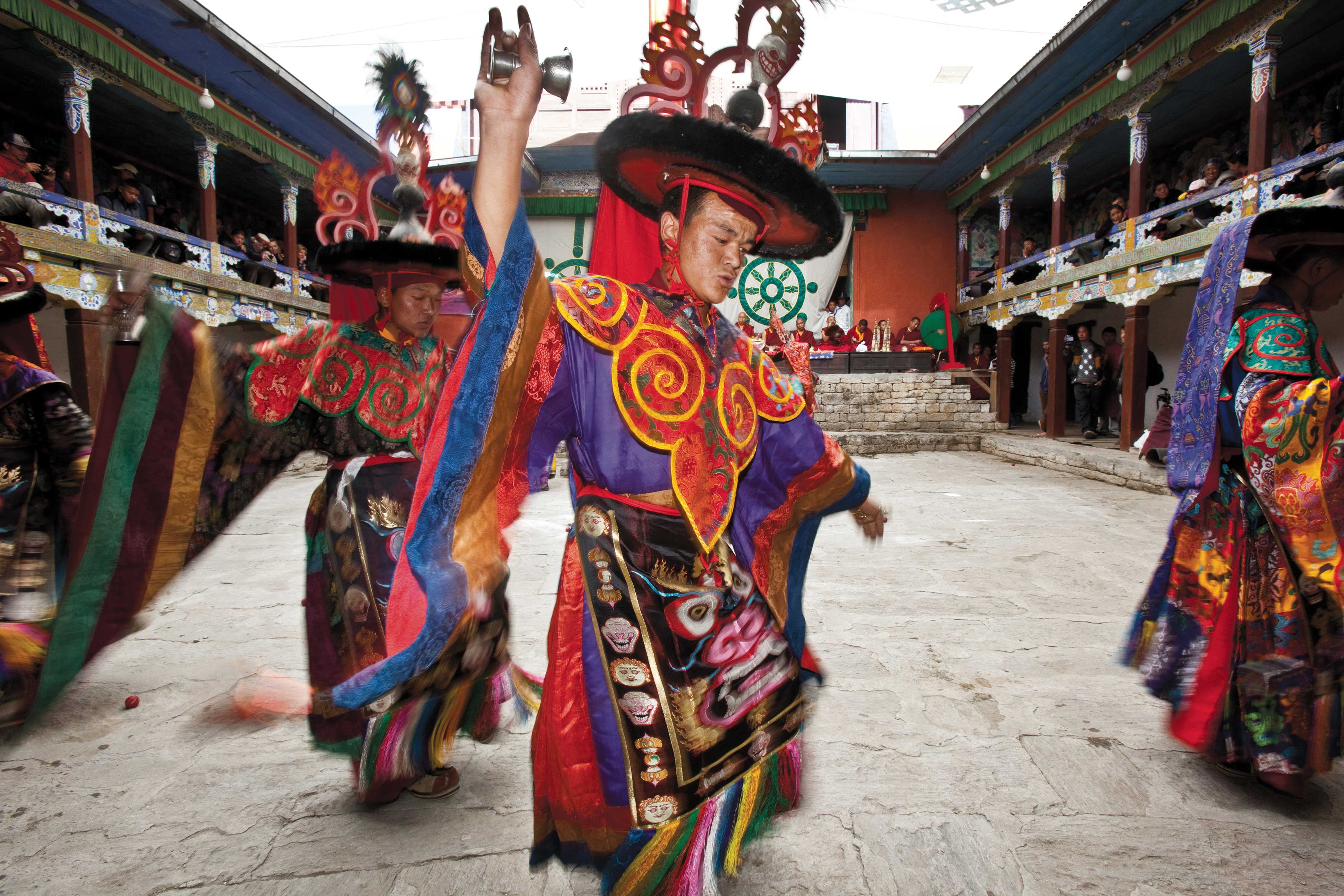
Attractions: Mountain views from Tharepati, village life, and the rich culture of the Helambu Sherpas. There are many Buddhist shrines and temples, prayer flags everywhere in the highest villages, as well as some nice forests to see, and yaks and sheep seasonally in the high pastures.
DOWN TO MELAMCHIGHYANG
After breakfast, I decided to descend to the village of Melamchighyang in the valley below. I quickly lost altitude down the trail, but it was hard on my knees. The trail took me down towards the Melamchi river, whose waters are about to be piped through a long tunnel to Kathmandu to solve the city’s severe water crisis. Melamchighyang, at 2,500 meters, is a big sprawling village with many lodges. Ghyang means temple, and a Buddhist ceremony was in progress at the local gompa (which also means temple). I stopped for snacks and tea and wandered around the village.
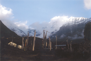
Kyangjin Gompa with Himalayan peaks, partly shrouded by clouds, forming the backdrop
The people of this region north of Kathmandu call themselves Sherpas, but they are distinct from the more famous Sherpas of the Khumbu and Mount Everest region farther east. Their language is derived from Tibetan. Stephen Bezruchka, a medical doctor and avid trekker who wrote the famous guide book, Trekking in Nepal, states that ‘Yolmo Wa’ – the People of Yolmo, more often pronounced ‘Helambu’ – might be a more appropriate name. Yolmo means ‘the place screened by snow mountains’. Indeed it is.
Helambu villages are prosperous and the interiors of large standard houses are very clean. From Melamchighyang. I continued descending, often steeply, and eventually crossed the Melamchi river on a long suspension bridge. A local legend tells of a fierce dragon that once guarded the river crossing between Melamchi and Tarkeghyang, the next large village. He was a demanding creature who required a human sacrifice before allowing travelers to cross. The ancient Buddhist sage, Guru Rimpoche, was put off by the dragon’s behavior and transformed it into a huge boulder. I crossed the river without sacrificing anything.
UP TO TARKEGHYANG
Once on the other side, it was a long, steep climb up to Tarkeghyang, and the correct trail was not often easy to find. I had to stop frequently and ask for directions. Helambu has a confusing network of trails and the correct one is often not evident. The trail you want may be narrow and indistinct, while a more obvious, broad, well paved track leads on to some other village. The trails often cut across ridges, and after laboriously climbing up one side you find that you have to descend steeply down the other.
The bridge I crossed was at an altitude of around 1,900 meters, while my destination, Tarkeghyang, was at least about 700 meters higher. I was not fast, and only reached the village at around five o’clock in the evening. While walking through the village looking for a place to stay, I found my Danish acquaintances drinking beer on the lawn of an inviting looking lodge. They invited me in. The lodge was neat and clean, and a great place to stay.
Tarkeghyang means ‘temple of a hundred horses’. The temple is supposed to have been established in 1727 by a lama who was invited by the King of Kantipur (ancient Kathmandu) to stop an epidemic. As a reward the lama was given 100 horses, which he brought up to the village. Many gompas (monasteries) here have their lay priests, or lamas, worldly men of the Nyingmapa sect who marry and have children.
Inside the lodge that evening, I sat before the fireplace in the kitchen drinking hot Tibetan salt butter tea. Helambu, it is said, is famous for its feminine beauty. The owner was a strikingly handsome middle-aged lady, whose young daughter was also quite beautiful. In ancient times, kings used to keep these ladies as concubines and gave them generous land grants.
THE BUS FROM THIMBU
The Danish duo was continuing to another Sherpa village on the ridge top, an attractive place called Sermathang. But I opted to descend back to the Melamchi valley to Thimbu. There, I was told, I could catch a bus to Kathmandu. They traveled the road newly built for the Melamchi Drinking Water Project. The bus journey, I learned, took about five and half hours and the last bus departed Thimbu at two o’clock in the afternoon.
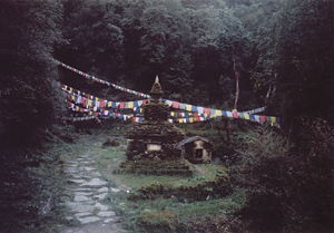
A chorten near Mangengoth
On the way down the trail, I passed through a small village called Kakani where the locals were repairing and repainting a gompa. The weather was clear and I had good views of the hills, the villages and the Melamchi Khola (river) far below. I could discern the houses and shops of Thimbu arranged in a linear fashion on both sides of the road. After a steep descent, I reached Thimbu and stopped for a well deserved lunch.
There I discovered that a bridge on the road was damaged. Since no busses could come up this far, I had to go down another 30 minutes’ walk to the next village. The unpaved road follows the riverside and, when I finally reached the bus stop, I was lucky to catch the last one of the day. The road was difficult and I admired the driver’s skill in handling the road so well. Not for a moment did I feel that he was not in full control of the bus. The road eventually joined the Arniko Rajmarga (highway) at Panchakal, and it was around eight when I reached Koteshwor on the east side of Kathmandu.
REFLECTIONS
Helambu is the most easily accessible trekking region from Kathmandu. The starting point, Sundarijal, at the north edge of the valley, is an hour by bus. The return, from valley, is a six-hour bus journey. The intervening trek takes one up and down the ridges through peaceful mountain villages, mostly Sherpa at higher altitudes. There, you can explore the rich culture of the Helambu Sherpas. The walk is strenuous, however, as the trail in many places cuts across ridges rather than following river valleys. The mountains are distant but the region is rich in sights and culture, and the people are friendly.
My advice is to carry a good map, and trek with a guide unless you are fluent in Nepali and can ask your way around, for the trails are tricky and difficult to find. Locals say that the name ‘Helambu’ is derived from two Sherpa words, he (potato) and labu (radish) – the two main crops of the area. Helambu is also famous for its apples and its beautiful Sherpanis (ladies). This beyul (hidden valley) is a great experience. Enjoy its charms.
Dr Ravi Shankar, MD, is a freelance writer and avid trekker who lives in Kathmandu. He can be reached at ravi.dr.shankar@gmail.com