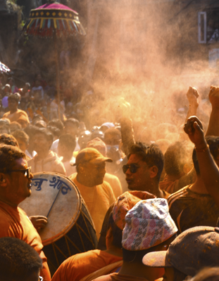
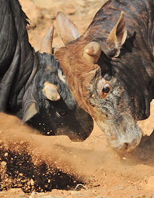
For those of us who may never see Tibet, one high corner of Nepal is preserving Tibetan Buddhist culture beautifully. Buddhists don’t celebrate Dashain (although they do, Tihar), and at this time of year, a friend and his family head home for a couple of weeks. This year, I went with them to see Manang through the eyes of a local. Manang, a central region of Nepal, stretches from Chame to Thorong La by road, overland to Phu, and almost up to the Tibetan border.
Dashain came early this year, and it was still stiflingly hot when we left Kathmandu at 5:00 a.m. one Sunday morning. Most people were heading out of the city, and like us, were hoping to beat the morning rush. Nepal’s not known for its pristine roads—let’s be honest, that’s not why anyone comes here, but after one day, we managed to get from the capital up to Dharepani in lower Manang.
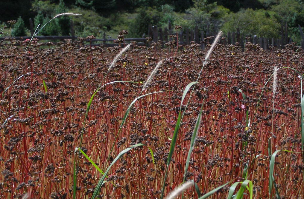
We hit Manang, luckily enough, in time to see the remains of a beautiful summer. Go any later than this fortnight, and everything will have changed color again. But, for now, the fields were burnt orange and vivid pink with buckwheat about to be harvested, and the yellow grass, long from a hot summer. If you go up to Manang when it’s raining down here in Kathmandu, you’ll see fields of bright orange crops with delicate pink buckwheat flowers dancing like butterflies atop the stalks. But, the risk of landslides on the road up from Besisahar is considerable. Many drivers refuse the journey. Dubbed one of the most dangerous roads in the world, even experienced off-road drivers come unstuck. Luckily for one team of adventurers, after a fast-flying stone pierced their jeep radiator when crossing a waterfall the day before we headed up, one phone call down to Kathmandu placed a new radiator in our jeep. This is reality in the mountains. You’re scuppered until someone comes to help you out. This treacherous road is a relatively new highway. Until quite recently, any journeys from Manang down to Besisahar, and even beyond to Dumre on the Prithvi Highway between Kathmandu and Pokhara, were taken on foot. Intrepid Manangis set off along trails, laden with goods and sleeping in the shelter of rocks.
The Rocky Road Up
For the first part of the Annapurna Conservation Region, from Besisahar to Chame, the road climbs a steep path, carved out of the valley side, driving over perilous rocky stretches and flowing waterfalls.
We took a welcome break from bouncing around in the jeep at an orchard in Bhratang, nestled among tall trees of the forest and a beautiful rest stop serving apples any way you like them. The pancakes topped with fresh Manangi apple compote were well appreciated. The orchard is home to a beautiful mountain lodge with dormitories and individual rooms, an oasis for trekkers on the steep road up.
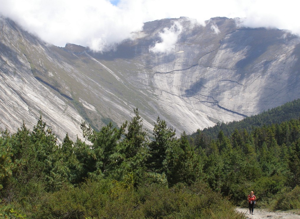
We passed the staggering Sworga Dwar/Swargadwari monolith, the “Gateway to Heaven”, stopping the jeep to gaze upon its enormity. Up close, there’s no way you can capture this in a photograph. The steep sides look smooth from the other side of the valley, slate grey with the occasional silver streak of water running through, deep fissures cast shadows, as do the white cotton wool clouds. The “Gateway to Heaven” is a sacred place, protected by spiritual and environmental law. No one may set foot upon it. Given its hostile appearance, I wondered who would want to? Some things are best admired from afar.
At Upper Pisang, the old village, and home to its monastery, I got my first closer glimpse of the peaks. After a restless night, we had slept ‘high’ compared to the night before, we were on the road by 7:00 a.m., walking this time, while someone drove the bags up for us. Bijay, a friend from Kathmandu, and a proud Manangi, smiled wider the higher we walked closer to his home. Up on the road from Pisang, he pointed out the local flora—pine cones dripping with sap, white-petaled wild roses and orangey-red rosehip berries and seabuckthorn. Wild oregano and thyme dotted the hillsides.
After Pisang, the road and the walking trail pass alongside the deserted Humde airstrip. In December 2017, Summit Air chartered a jet, taking World Wildlife Fund researchers up to Manang to observe snow leopards. Over the years, several domestic airlines have sent trial flights up, but none as yet have resumed regular commercial flights, which would provide a lifeline to the Manang region, much as flights to Jomsom and Lukla do for Mustang and the Khumbu.
Snow leopards live in the Himalayas at between 3,000 m and 4,500 meters. Their numbers are reducing; they are listed ‘vulnerable’ by the International Union for Conservation of Nature, and Manang is one of the best places to observe them. However, unless you are a dedicated tracker, you are more likely to see the signs that a snow leopard is nearby, rather than encountering one. They have been known to scare horses straight off cliff sides. Sighting blue sheep is a tell-tale sign that the even less extroverted snow leopard is well-camouflaged somewhere nearby. A leopard has to eat, after all.
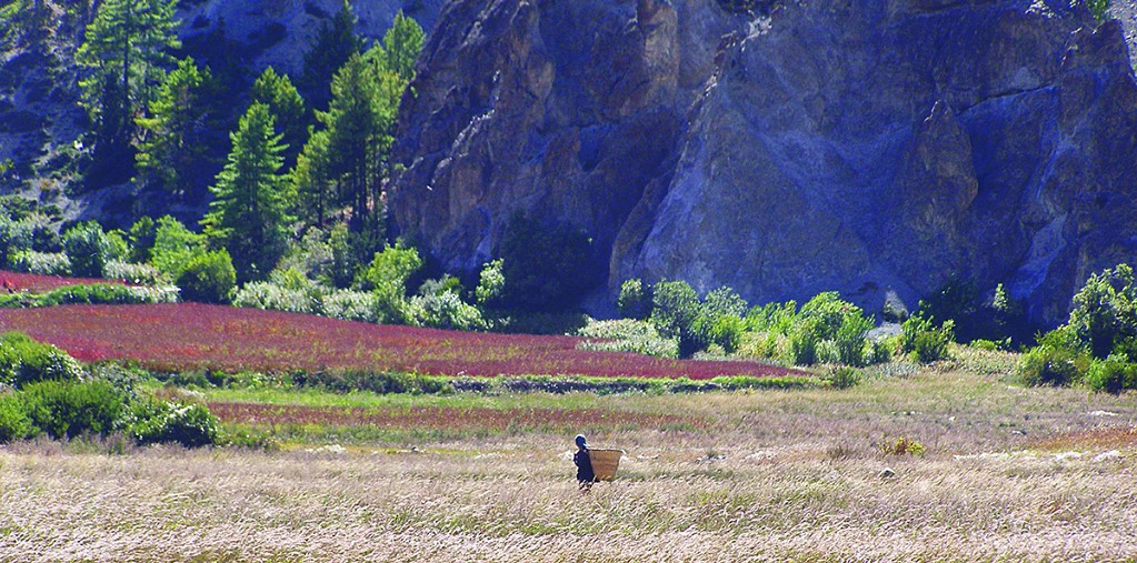
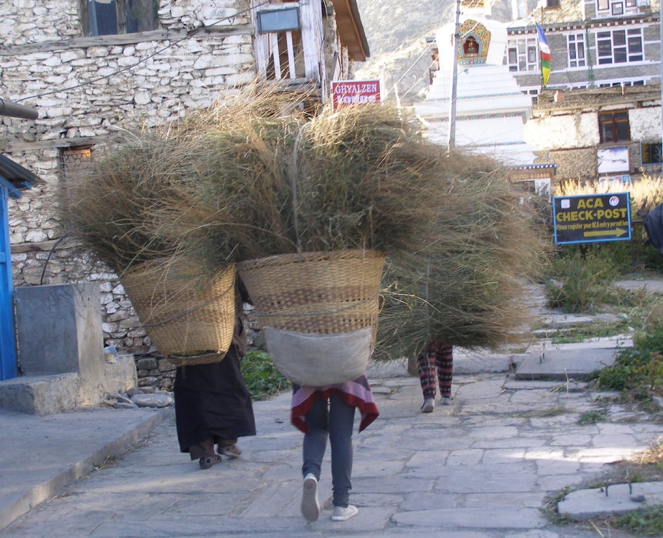
In summertime, Manangis keep the animals—yaks, oxen, goats, sheep, and wild horses—up on the high plains to graze, while grass and crops grow on the lower fields. As we arrived, we learned that the Lamas had given the nod to Manangis to harvest the grass and bring down the animals. Villagers across the region picked up scythes and headed into the fields, and the village was a hive of activity, as everyone drops their ‘other’ work to harvest. On the main street, and in old Manang’s dark and winding alleyways, priority is given to the bent figures of field workers hauling kilos of hay back to the village. Only once the harvest is home can the herds release the animals down into the valley.
One day out walking, we crossed paths with an escaped yak thundering down a steep hillside, dust and dirt flying in its wake, and pursued by hapless yak herders. In the end, the beast was left to its own devices, as the herders realized there was little they could do to stop a half-ton beast that had taken flight. A day later, the animal was sighted in a valley bottom prairie, happily eating away on what remained of the uncut harvest. Any animal found in breach of the strict grass eating laws find themselves in jail. When I was up there, three horses and an ox sat in chokey, waiting for their owners to bail them out. This yak had luck on its side.
Manang itself has two parts. The first part, which you hit just after entering the old village gate and spinning the ubiquitous prayer wheels, is where you’ll find hotels and guest houses to suit all comfort requirements—from the luxury of individual bathrooms to the more exhilarating cold water straight-from-a-tap in the backyard. You’ll find bakeries selling excellent bread, cakes, and cookies, coffee houses, and tourist and trekking paraphernalia, as well as the local cinema hall. While the road up to Manang is breathtaking, the sight of a cheese and mushroom panini on a bakery menu was a more than welcome sight. Even two days on the road had this traveler craving some home comforts. You find a good mix of Tibetan dishes—thentuk, thukpa, tsampa, yak steak, and a personal favorite, cheese and potato momos—alongside great Western-style dishes such as pasta, pizza, schnitzel, and burgers.
Not long ago, as many a Managi will attest, this was all fields with barely a building in sight, let alone restaurants. Between the newly-built bungalows and two-storied hotels lies agricultural land belonging to local families. Old Manang hits you further along the narrow main street, wide enough for a bike, a narrow cart maybe, but certainly not a car. The car road runs below Manang, next to the mighty Marshyangdi River, and up to its end at Khangsar, the last village before Tilicho Lake.
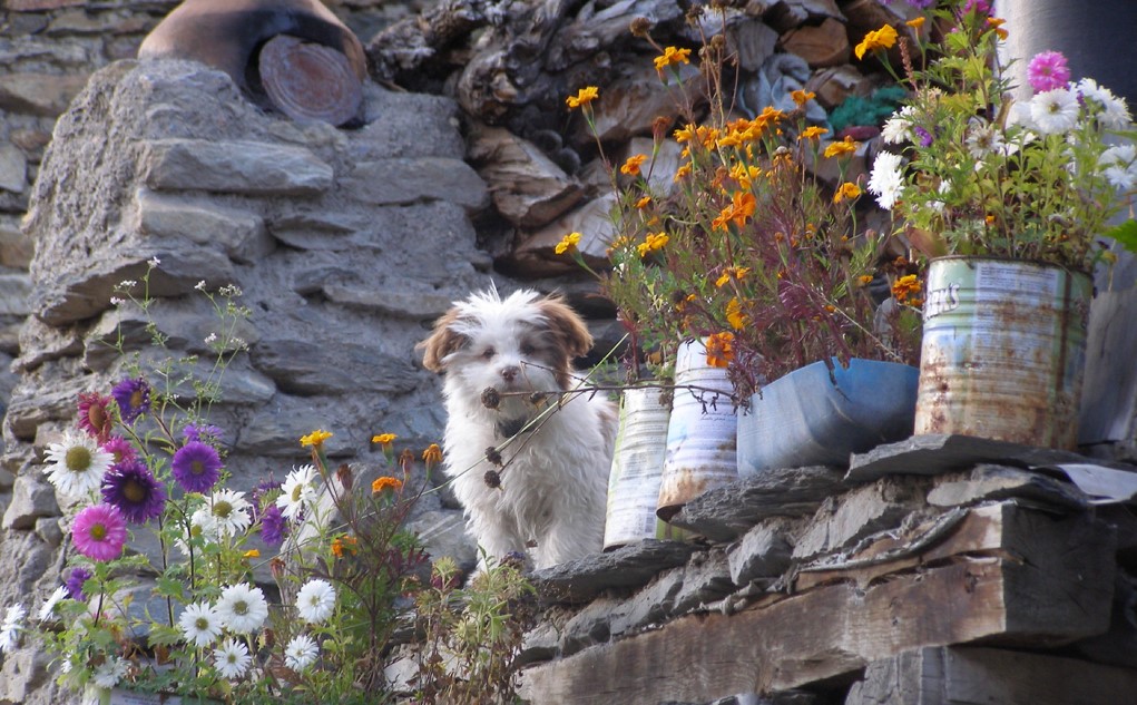
From further up the valley, it’s difficult to identify the houses, camouflaged against the mountain they are made from. In the last days of summer, they are adorned with flowers; tall pink hibiscus flowers climb the walls, orange, white, and purple daisies spring from old paint pots. There’s house-pride in them there hills. Many of the old houses are still in use, and while villagers share three public water taps, each house has its own toilet. Built to withstand the harsh Himalayan winters, you enter houses through a short, sturdy, wooden gateway, cross a yard that was made to stable the animals—mules, goats, yaks, and horses. One local family, for whose daughter we’d brought a warm winter jacket, invited us in for tea. They still live on the first floor, accessed by shallow-runged wooden ladders leaning casually on the house beams. Inside, dark windowless rooms were painted in muted colors, centered around the traditional clay fire on the floor. Flat rooftops, where the cut grass is stored for the winter, and first floors adjoin in most buildings. After tea, we climbed down the neighbor’s ladder into their yard and out through a different solid wooden door. Bijay pointed out the old houses of Manangi people I know in Kathmandu, and the narrow streets, where some thirty years ago, they all played. He and his brothers, he added, used to sleep on the first floor terrace, between the animals and the stars all year round under a heavy, rough, yak wool blanket.
What’s the Hurry?
More than 110,000 people trekked the Annapurna Circuit in 2016, according to the Ministry of Tourism, with most staying in Manang only to acclimatize. The brilliant Himalayan Rescue Association offers daily talks on the perils of walking up and over the circuit’s highest peak, Thorong La, some 2,000 m higher than Manang at 5,416 meters. Meetings are replete with earnest and wise walkers, although many want to get up and over as quickly as possible. Some of my sputniks (fellow travelers)—a Belgian, two Manangis, and a Manangi-Belgian—had crossed Thorong pass several times. But, this holiday was all about taking it easy.
We spent our few days in Manang taking a leisurely pace. A day’s walk up to Chongkor Viewpoint is a steep, but worthy, climb to spot the timid blue sheep, or bharal, specific to the Himalayas. The Chongkor walk is an excellent acclimatizing trek for those heading over Thorong La.
Heading east out of Manang, sits the Brakha Gompa, one of the oldest monasteries in the region. We arrived during a puja, a Buddhist ceremony, said to be for the animals sacrificed during Dashain. We were ushered into the crowded main hall and offered seats on the floor at the side of the congregation. The protection mantra Om Mani Padme Hum resounded, the air think with incense, hunched figures of elderly Manangi men and woman rocked back and forth while shafts of light from high windows cast upon statues of the Buddha and his demonic protectors. Cups of ghyu chia (butter tea) were passed around, as were 100 NPR notes from the member of the congregation sponsoring this puja. With a peal of bells, the chant changed to a higher tone, the devotees now singing in unison, putting an end to their morning prayers just in time for a dhal bhaat lunch. Manangis are Tibetan Buddhists, who follow teachings brought down from Tibet in the eleventh century by two monks, who also brought literacy to these isolated mountain settlements. The temple caretaker in Manang’s own gompa proudly dusts off a wall of ancient-looking scrolled Buddhist teachings, many of which, he claimed, came from Tibet.
After a peaceful morning, we followed Tashi Ghale back down to the Manang valley floor, where we crossed the river at one of its lowest points, in search of a lone woolly-necked stork. A shepherd had recently spotted one in the area, the highest ever sighting. While not keeping an eye open for rare breeds flying by, he tends his flock of 30 goats and 30 sheep, trying desperately to keep them away from nearby fields abundant with uncut grass. Sitting outside his humble shelter, he contemplated his landscape and shifted prayer beads between finger and thumb.
On our last day, we made the less high but longer walk along the path towards Tilicho Lake, as yesterday's trekkers passed us on the way down. As the route diverged towards the lake, we carried on due west, following a path along a steep hill, beneath bright blue skies, and with the furthest reaches of the Annapurna Range in the distance. The views up here are something to behold. Annapurna II, III, IV, and Gangapurna and its vastly reduced glacier are all visible from Manang village. You don’t need to wander far for breathtaking vistas. On this trip, I did not visit Milarepa Cave, Tilicho Lake, the upper reaches of Yak Karka (infamous now due to the wide media coverage of the unsavory event where a British tourist complained about the price of tea and fell foul of Manangi temper), Nyawal, and the Guru Rimpoche’s cave, or Kicho Tal Ice Lake. But I will.
Spending early mornings on Manang’s main street with a hot cup of tea, watching the sun creep over the mountain tops, harvesters carrying loads of grass and moving aside for the occasional mule carrying goods up from down below, seemed a far better pastime. I’ll get over the pass, eventually, but in the meantime, I’m happy hanging out in Manang.
Author’s Note:
I thought it worth mentioning the enormous efforts made by Manangis and other mountain communities to keep tourists warm, fed, and watered. The high trail tea shop owners carry every drop of water and every lump of sugar with them, sometimes 1,000 m up a mountain. If they charge the equivalent of USD1 more than you’d pay for a cuppa down in Besisahar, would that really break your bank? Shopkeepers and hoteliers in Manang are well-versed in negotiating prices with tourists, although trying to bargain down the price of a boiled egg or bread roll did seem a tad insulting. Our role as tourists, because that’s what it says on the visa, is to participate, to enjoy, and to spend our tourist dollars in local businesses. The higher reaches of the Annapurna Circuit are almost inaccessible for half of the year, either due to cold or the risk of landslides. Businesses up there must survive. They are not ripping you off, taking the piss, or trying to bust your budget. Be ethical, be responsible, be reasonable.
