 During the monsoon it’s a good idea to avoid trails that get too muddy and are too narrow. Slipping and sliding is fun as long as you don’t hurt yourself, but it’s better to be safe than sorry. Taking the broader roads means less chances of attracting those dreaded leeches, which are a nuisance during the rainy season.
I start my hike at 8:20 from Magar Gaon above Bhainsepati towards Chovar, because from here on, there is not much traffic. Soon after, the road climbs a wee bit, and I come across a smaller blacktopped road known as Shanti Marg that goes left, and I take that route. By 8:30, I come across a group of houses and a broad concrete road climbing steeply on the right. This leads to the Batsala Devi Temple on the hilltop. The road veers left after a short climb, and at the end is a stone staircase on the right that goes straight towards the temple. On my previous visit there was no priest here, but now a young priest and his family live within the premises. “We’ve been living here for a year now. My house was destroyed by the earthquake and I am rebuilding it,” he says, partly explaining why he lives here. The temple is simple but has a large compound with many tiny shrines besides the main temple under a pipal tree. From outside the temple, there are great views of the extensive, verdant rice fields, with Khokana as a backdrop, and across the Bagmati on the right you can see Tauda lake and the surroundings, all from this vantage point.
Instead of following the main road, I take the rough track that goes down from the east side of the temple. There is no clear path, so I walk on the grass to the right to reach it. The path can be seen clearly if you climb a spiral staircase to reach the roof of the priest’s house. The path is not very muddy, except for the last portion. You can see the white façade of the Jal Binayak Temple and the Bagmati River soon after it emerges from the narrow Chovar gorge and heads out of the valley. I walk near a cluster of pine trees listening to the sound of dozens of birds and reach the main road coming from Magar Gaon at 9:00 a.m. It goes on down to the bridge at Chovar gorge, but there is a short-cut to avoid the traffic which gets quite heavy and polluting around here.
A group of bikers come toiling up the hill. “Where are you headed?” I ask, and after a momentary struggle to remember the name, the foreigner says, “To Dhapakhel.” You begin to see the birds that flock around the Bagmati River as you look down. I cross the bridge and look back up the hill to see at least half a dozen restaurants on the hillside. They have better food than down below. Here, below the Manjushree Park, there are quite a few cheaper eateries. It’s 9:20 am. Several local buses are parked nearby, and one of them has an interesting route. It starts here, climbs up the hill, but avoids Magar Gaon and Bhainsepati and instead goes down and heads straight for the Medicity Hospital, which cuts down the journey considerably, reaching Ring Road, Ekantakuna, in about 10 minutes. From there, it goes to Jawalakhel, Lagankhel, out to the Ring Road again, to Koteshwar, and via Putali Sadak, it heads towards Naxal, Maharajgunj, and goes all the way to Budanilkantha. The other buses go to Ratna Park via Bhainsepati.
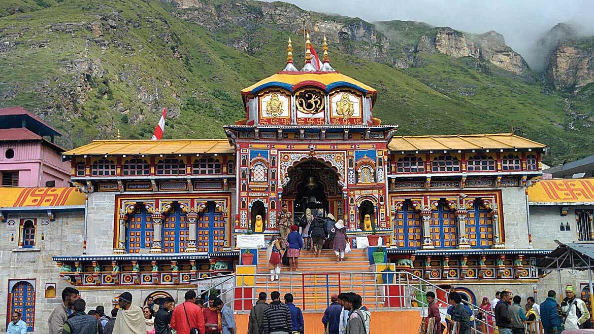
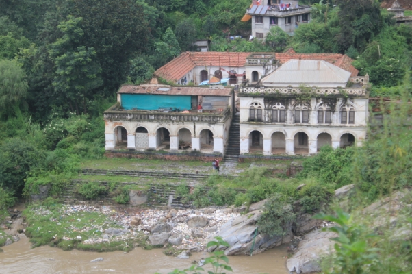
The Jal Binayak Temple beside the Bagmati lies below the row of shops. The earthquake of 2015 destroyed the main shrine and it has been torn down to the ground. However, the building that surrounds the temple still stands. It’s the outer white structure that we see from a distance. Be very careful while walking down towards the river from the temple, as the large stone steps can be dangerously slippery, especially if you are wearing your hiking boots with tough rubber soles. Further downstream is the remains of the old cement factory that was closed down because of the severe pollution it caused all around.
At 9:45, I start walking back towards Kathmandu along the main road, and it turns sharply right to come up to the top, where there are makeshift shops selling snacks. You can also walk through Manjushree Park to arrive there, but it’s steep. It takes about 10 minutes to reach the top. There’s a motor road going up on the left that leads to Chovar village on the hilltop. The new monastery that’s still under construction can be seen sitting at the top of the hill. It’s a short walk to Chovar village past Thapa Gaon. According to locals, the Thapas were brought here by Prthivi Narayan Shah after the invasion, as Chovar is a Newar village predominantly inhabited by Maharjans. The first thing I come across is a tea shop with a spectacular view of the valley. One can truly relax here, drinking the old man’s tea and watching the ever expanding city sprawled below. It’s 10:00 a.m. now.
Nearby is a white chaitya and turning right from the pati you can see the old Aadinath shrine. There are some old Newar folks at the pati playing the ancient game called pasa. The inside walls of the rectangular building surrounding the shrine has metal plates nailed onto them. The belief goes like this: if you give up something that you use every day and is valuable to you, you gain merit by handing it over to the shrine as a kind of sacrifice. The shrine itself was partly damaged by the earthquake of 2015. A large colorful prayer wheel can be seen in one corner and many small ones that have seen better days, around the shrine.
Instead of going back down to reach the monastery, it’s easier to approach from behind it. So I walk past the white chaitya that one first comes across here and I go further into Chovar; there’s a small track going left towards the gumba (monastery). The track goes around the boundary wall of the gumba and reaches the front gate. There’s the old smaller monastery on the right which is run by Buddhist nuns alone, which includes blowing the long horns and doing all the pujas on their own. Next to it under construction is a massive monastery which once completed will completely dominate this little village. I climb up the stairs and reach the roof. What a glorious 360 degree view of the valley below! I’m ecstatic going around the roof from corner to corner taking pictures of the city on one side and the villages on the other. When asked, the senior nun tells me, “This is Chovar Gumba.” But I’m sure it has an official name which is usually in Tibetan.
I retrace my steps around the wall and go back to the village but this time I head down and discover Hari’s Coffee Shop. Hari Gubaju tells me, “I’ve been running this shop for about fifteen years now.” He makes really good coffee and it’s a reasonable Rs 55. Chovar is amazingly peaceful; as I sit on the doorstep of his shop sipping coffee, all I hear is the sound of birds and the distant tapping of a carpenter at work. It’s been drizzling all morning, but now the sun comes out for a brief spell. I’m told if I carry on down the road I will reach Panga. One of the landmarks is a large pipal tree along the way. “Go past the big tree and follow the pitched road,” says one of the Chovar residents.
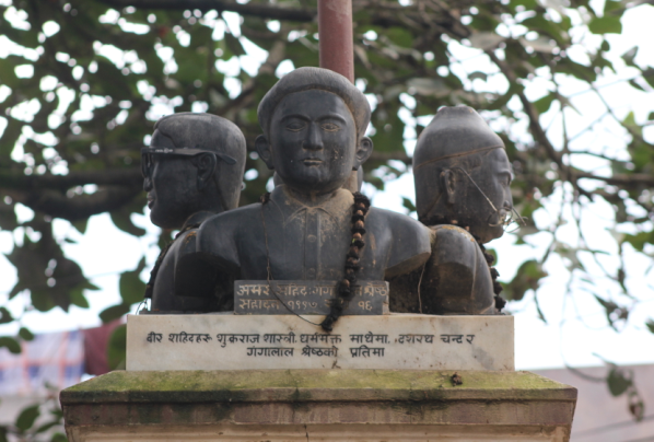
At 10:45, I’m ready to move once more; it begins to drizzle again as I bid goodbye to Hari. I follow the pitched road that later turns into a concrete road and it’s very steep making me take careful, smaller steps. But the first settlement I reach is not Panga. This is Itagol I am told, and I turn right at the end. Further on I finally reach a four way crossing from where Panga begins. You can walk from Chovar to Panga in less than 30 minutes. The main road is actually a parallel road on the right which meets this smaller road at the next crossing. Next to the large pipal tree at the crossing are the busts of the three famous martyrs who were executed by the Rana regime.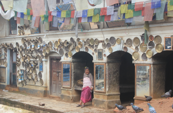
My interest in Panga was aroused by a book entitled “The Newars” by Gopal Singh Nepali as most of his research was based on this settlement. Panga is quite big and many buses arrive here from Ratna Park. But there are not too many quality eateries and the place itself has nothing much of interest. There are better restaurants at the bottom of the hill where the road from Panga meets the main road to Dakshinkali. The first one is called Missed Call Restaurant. The name may be strange but their tea is petty good.
If you haven’t had enough walking for the day, a hike up to Kirtipur is quite interesting. There is a direct road going up to the Bhairav temple in the town. A Thai temple known as Shri Kirti Bihar has been built just below the city which is worth a visit. At the top of Kirtipur are located some remarkable pagoda-style temples among which the Bagh Bhairav temple is distinguished by the weapons nailed to the walls of the shrine. These weapons were used during the epic battle against the invading Gorkhali forces of Prithvi Narayan Shah in 1767. Kirtipur is one of the historic places in the valley as it put up a strong resistance before it eventually capitulated and surrendered to the Gorkhali troops. The town is also known for good Newari food and great views of Kathmandu.