Of all the hikes I’ve done, this was the most unusual; it was all downhill. As with all things, or almost all things in life, there is a reason behind it. Or to be more precise, there were two reasons, in this case! The more compelling reason was the fact that I hadn’t walked for months, and walking uphill was out of the question. The other reason was that, as usually happens, I had seen this long stretch going all the way to Naubise on one of my excursions to Bhimdhunga, and standing on top of the hill, I had looked down and said to myself, “One day I am going to walk all the way to Naubise.” And so I did!
So “where is Bhimdhunga?” would be the first question on many people’s minds. If you go up from Swoyambhu beyond Ring Road to Sitapaila, the road goes on to Ramkot and further up at the edge of the valley is the hill known as Bhimdhunga with a number of settlements. Either take a private vehicle or catch the bus from Ring Road, Sitapaila. The bus is always overcrowded, so it is definitely not a pleasant ride, but you could always persuade a taxi to go all the way. You do find taxis arriving there with local passengers. The buses these days climb up to the top of the hill and go on to meet the highway below Bhanjyang (Pass).
Once you reach the top of Bhimdhunga, you will see the largest landmark around Naubise, the cement factory, which gives you a rough idea of how long the hike is. Tea and snacks are available at the little eatery on this hilltop. Then comes the major decision; there are two ways to go down the hill: one is the long and winding motor road, which is also dusty, and the second option is a very steep track that has been opened up by the owner of a house down below. But once you reach his house, the road ends and one must follow a loosely marked short cut that goes through someone’s farmland and a bit of tricky terrain. To take this second option, make sure you are wearing proper hiking boots, and you will also need a walking stick, even if it’s an improvised one you found along the way. The stick is just to help you keep your balance as you walk on the narrow and wet embankments of the vegetable farm. I was lucky to meet the lady of the house, who not only gave me directions, but also provided me with a home-made walking stick. If you don’t have experience walking on narrow, slippery, wet, and faded trails, you might want to take the first option and bear the dust each time a vehicle passes. However, vehicular movement on this motor road is quite light, so don’t feel discouraged.
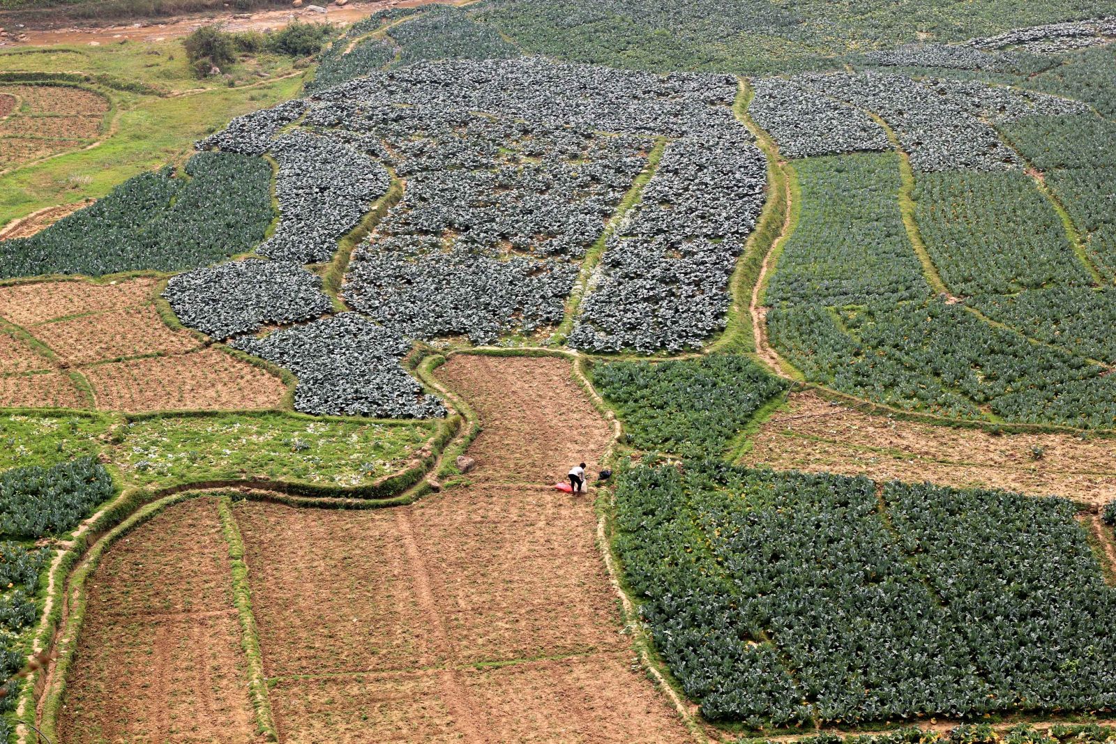
I chose to walk down the steep muddy path, and luckily for me, the rain was just a drizzle. I wouldn’t do this hike during the monsoon and neither should you. The initial downhill hike is hard on the knees even for young hikers, but mercifully, it is only up to the house. Beyond the house, the path twists and turns and it takes a bit of experience and the ability to guess which should be the right path. However, it’s not a place where one could get lost, so you can always retrace your steps to get back on the right track. A broad motorable road can be seen below, and that’s where you want to come out. A part of the way is along the riverbed, after which you encounter the terraces with confusing paths. Take it as a challenge/adventure, which it should be, and find your way to the road below, where all I encountered were motorcycles a few times.
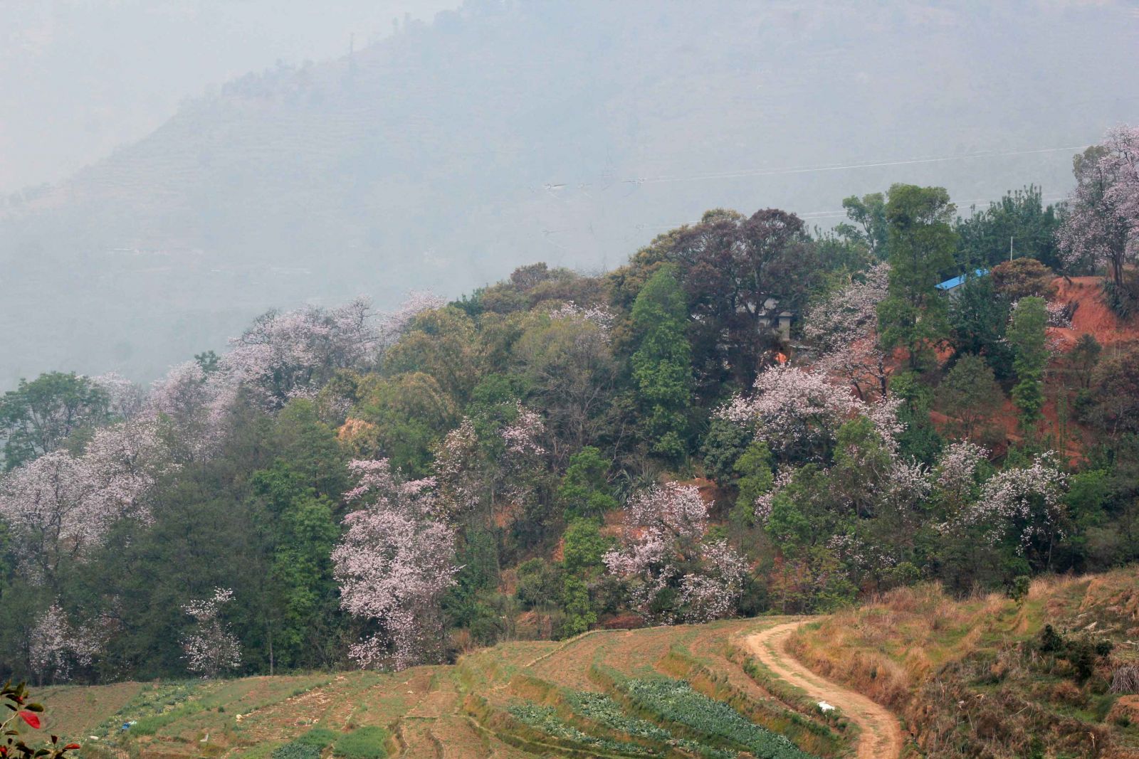
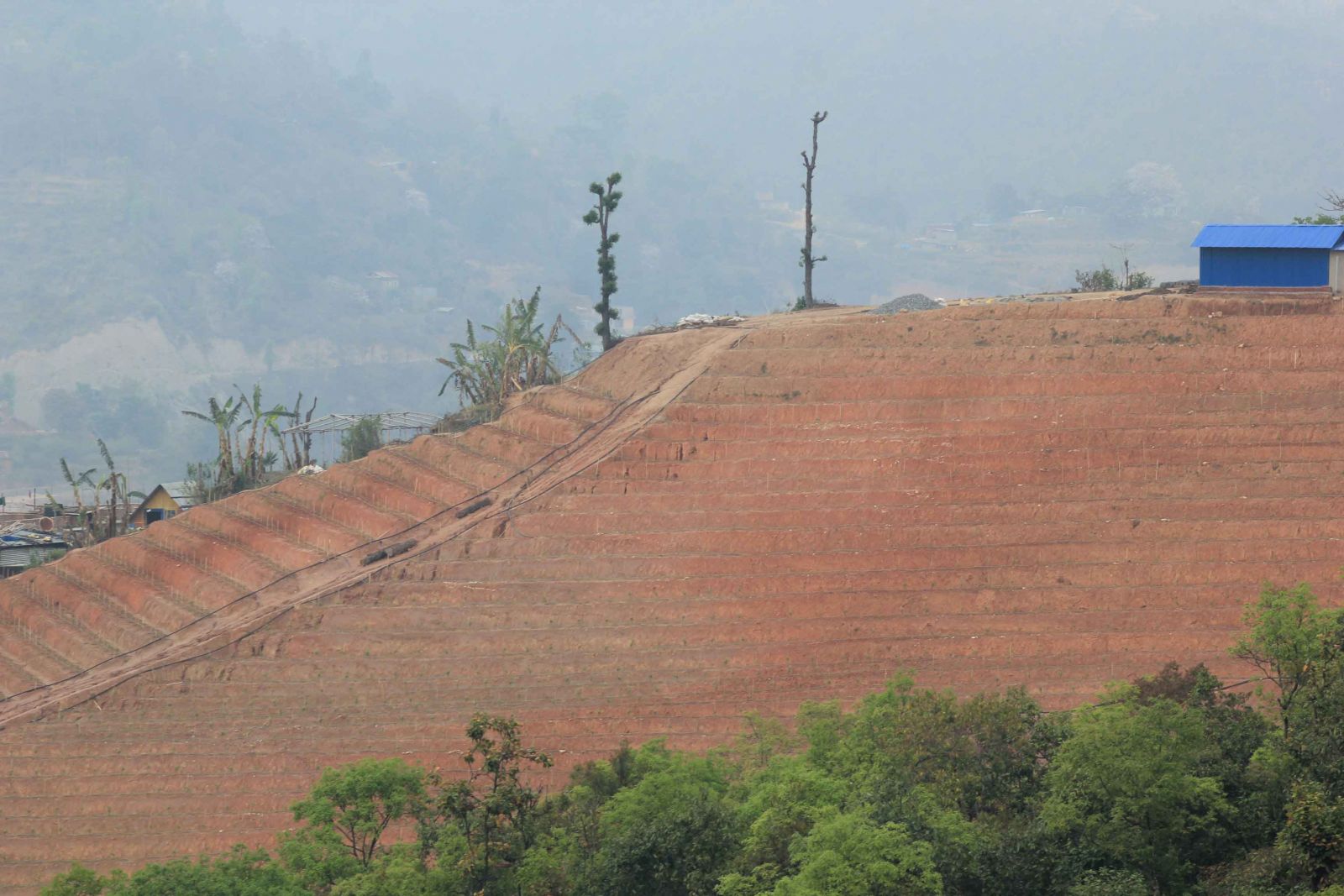
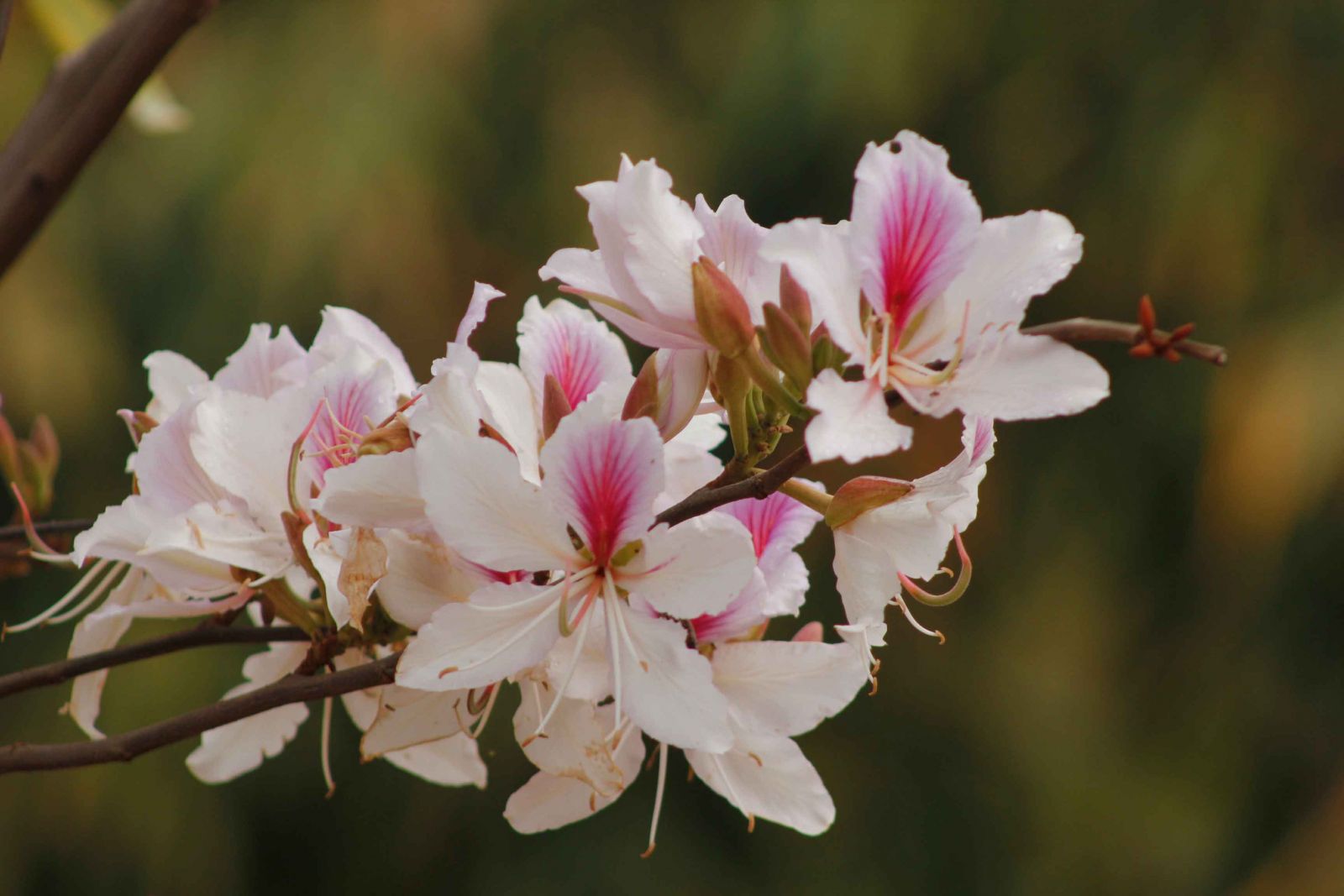
As you approach the motorable road, you begin to notice flowering trees on the hills nearby, which is a delightful sight. Blossoms of varying colors light up the hills, but the locals are delighted for quite a different reason. The commonly found flower here is the ‘Koirala’ (Bauhinia variegate) which they pluck and make achaar to go with their daal bhaat. These flowers cover the entire tree, with barely a leaf visible. There is a small settlement here, and tea is available in several places. Little knick-knacks are also sold, as the people here are turning to brick production, which has brought in a large number of laborers from Nepalgunj. These brick factories as we call them are turning what were once green terraces into red mud flats. And, with the amount of pollution they generate, it is indeed a sad sight to behold. In place of verdant hillsides, we now see smoke-belching chimneys and a sea of red. An interesting addition is the mules and horses that they now employ to carry the bricks. So, don’t be surprised if you see a string of horses or mules grazing nearby.
Along the way I came upon a small settlement of Newar people, where I decided to stop for lunch. On such routes, I carry sandwiches and fruits as one can never be sure what kind of eateries there are along the way. I found a large trunk of a tree by an open space, and it was perfect for relaxing while I sipped on a drink. Beyond this point there was yet another choice to make. A road going left, I was told, leads to Naubise, while the one on the right would take me to Dharke, which is further down from Naubise, along the highway. You can go straight on to Naubise, but I was killing two birds with one stone. I was interested in visiting a Tamang family that lives between Naubise and Dharke, to whom I had delivered some relief material after the earthquake of 2015.
Taking the road going right, I followed it for about half an hour to a stream, from where I took a road going up to the top of a hill on the left. Nearby, I could see large blue, impressive buildings with countless windows, so I asked an old man sitting outside a house what they were. “Oh, they are for keeping poultry,” was the surprising reply. Using a large pipal tree on another hilltop further down as a landmark, I followed the motorable road, which led me to a vineyard on a hillside. Stopping to have a cold drink, which I only consume on hikes, I met a man who arrived on a motorcycle. He asked me, “Do you want to see where we’ve planted grapes?” My curiosity aroused, I followed him to the hillside where they have transplanted hundreds of little saplings. They plan to make wine, and I wished him luck.
I climbed further up through a light forest until I reached the top and walked along the ridge keeping my eyes on the big pipal tree, as I knew the Tamang family lived in the village immediately below it. There are great views from this ridge, with farmlands on one side and the highway to Narayangadh on the other. On a clear day, the Himalayas are seen in the distance, with Ganesh Himal dominating the range. After visiting the family, I climbed down and walked beside the cement factory to reach the highway. It’s then only a short walk uphill along it to reach Naubise, where eateries seem to be growing like mushrooms. After eating, drinking, and relaxing, one can either ask to be picked up from here, or catch one of the smaller buses headed for Kathmandu.