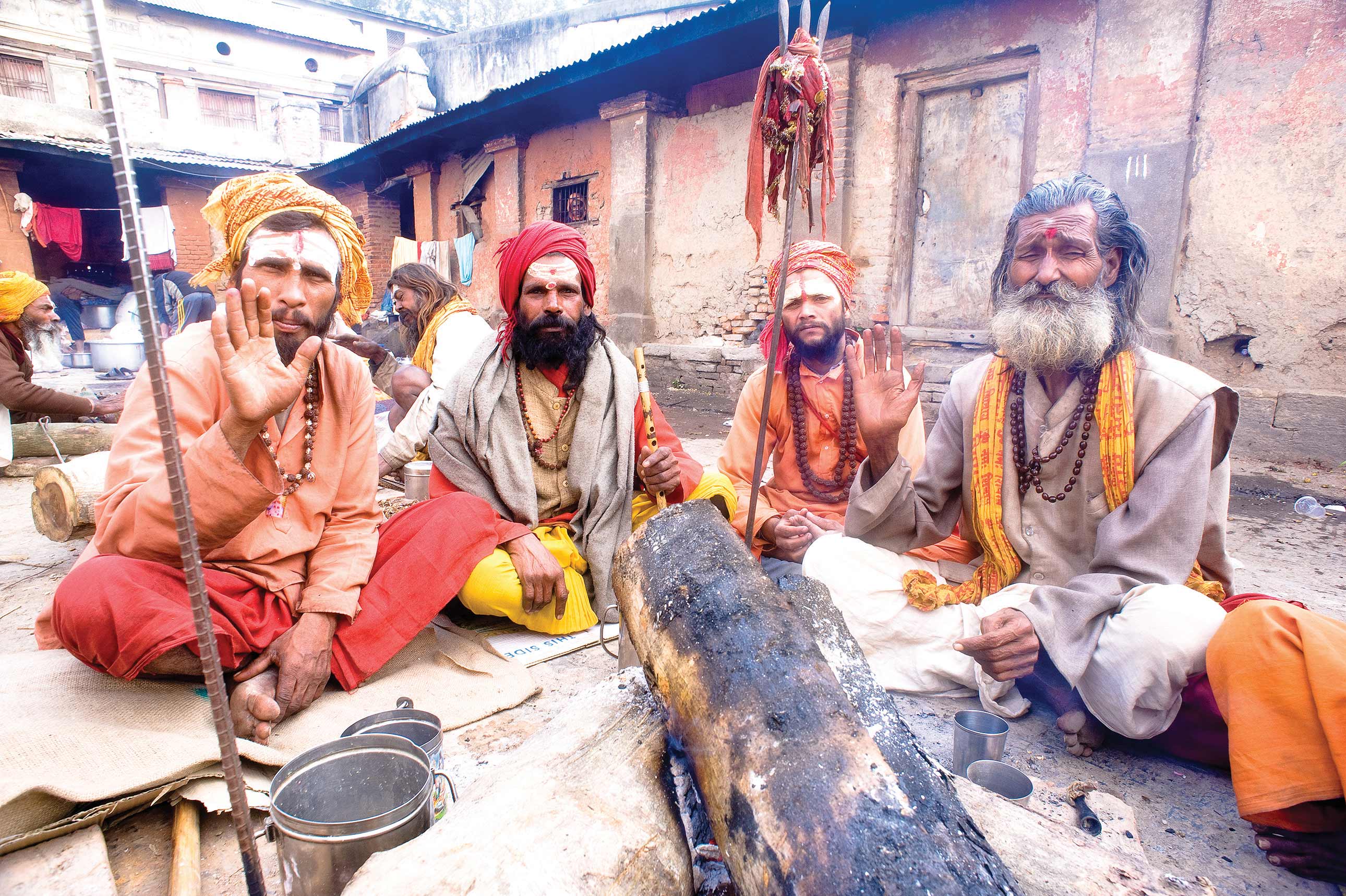
A trekker on the Great Himalaya Trail recounts some of his memorable parts on the trail.
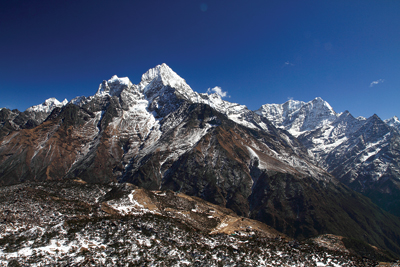
On March 23, 2012, after walking 19 kilometers from Lamsung, the Climate Smart Celebrity Trek members led by Apa Sherpa arrived at a small village called Chhentung in Baglung district. We walked through a long stretch of rhododendron forest and crossed the Jalja La pass at 3404m. This is also where we entered the Dhorpatan Hunting Reserve. What was remarkable about Jalja La pass was the view. One could see mountains like Dhaulagiri, Gurja Himal and the Annapurna range aligned together to form a magnificent landscape, perhaps even more spectacular than the view from Poonhill. At least that was my impression and the general consensus among most of the 21 members of our team.
There is one more bit of trivia about the place. Back in the insurgency period, the Maoist combatants had used this place to camp before they attacked Beni. Locals told us stories of how the Maoists had marched through this route in thousands to launch their offence. We thought this was a part of our history - an important event. We decided to it call it the Guerrilla Trail. This is of course unofficial, just for namesake.
 Right after crossing Jalja La pass, the topography and landscape or the trail changed completely. After rhododendron forests, we were now walking amidst arid and pasture landscapes. There was no sign of human settlement except for a deserted house. The locals in Lamsung village had informed us that we would not find any villages in between. We carried with us lunch packs consisting of a packet of biscuits, Tibetan bread and two boiled eggs each.
After walking for almost 2 hours from the pass, the trail led us to a pine forest in the Dhorpatan Hunting Reserve. The journey was getting exciting primarily because of the variation in the landscape we were seeing within such short time spans. None of the members in our team had trekked here before and this place had various elements of surprise with wonderful scenic beauty. However, much to our dismay, all this changed when the greenery of the forest started to turn grey and trees started to resemble huge, ugly matchsticks standing desolately. As we walked further down, it started to become clear that this was due to a forest fire.
The fact that there was no sign of any re-growth in the forest indicated that this was more or less a recent event. What was sad though, was that this trail of ashes and burnt pinewoods continued for almost an hour.
Roughly speaking, this forest fire had destroyed about 3-4 km of forests on both sides of the trail. This is because on an average, we walk 4-5 km per hour on a plain trail. When we reached the next village called Gurja Ghar and later Chhentung, I inquired about the forest fire. None of the locals could give me a convincing answer as to what sparked the fire. Some said it was the Maoists, others said it was the police during the insurgency, and many said they weren’t aware of the forest fire, something that had occurred merely 2-4 km away from their villages. At this point, I felt that something wasn’t right. Perhaps, it was the locals themselves that had started the fire to claim the land.
 We arrived in Chhentung at dusk. It was probably around 6 pm and we had already walked for more than eight hours. Our two Sardars (the leader who handles the logistic arrangement for the team) got busy looking for accommodation and a site to camp. After dinner at eight, we had retired for the day by nine.
After having spent the night in Chhentung village in Baglung, we planned to reach a village called Thakur in Rukum. On inquiring, the locals told us that we could take a shorter route thus bypassing Dhorpatan village. As always, we started at 8 am in the morning and requested the locals to show us the way which one man finally agreed to. He was in his sixties and had a hard time catching up with us. He abandoned us in less than 2 hours when we reached Chhentung pass at 3712 m. We were on our own now.
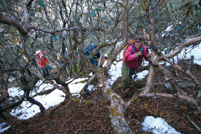
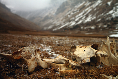
The terrain was unique. No sign of life here – just some dwarf rhododendron forests with patches of snow. At some places, these patches were more than knee-deep. It seemed like a pasture, a habitat for Blue Sheep but there were no traces to indicate any such activity. At one point, all of us got lost in one of the dwarf rhododendron forests. The strange thing was that we could all see where we had to go but we couldn’t find a trail to get there. The snow and the web of rhododendron trees distracted our course and some of us including Saurav (Dhakal, British Council’s Climate Champion) and I had to skid on the snow to reach a regular trail below. Dawa (Steven Sherpa, co-leader of the trek who has climbed Everest 2 times) and Samir (Jung Thapa, professional photographer) took the high route.
After walking for more than four hours from Chhentung, we finally sat down at a random spot to have our lunch. Like the day before, today was also a pack-lunch day. The food was more or less the same except for some slices of Yak cheese, a luxury at that point.
 Until then we had not seen anyone on this trail except for the old man who had deserted us. The trail started to go up to another pass after lunch and by half past two we were up at Phagune pass at an altitude of 4161m. This was the highest point we had been at since we started in Barabise on February 24. Even the team members who would usually run ahead were feeling the altitude and were now falling behind on the trail. Soon after the pass, the trail started to descend down into a gorge, which to me felt like a no-man’s land. After trudging down for about an hour, we came to a fork in the road. It was already past four at that time and we had no clue where Thakur village was. The group ahead had already taken the trail that went down, so the remaining crew followed them. Much to our distress in the darkening hour, the trail turned out to be dead end. The group that went ahead started to return upward on the slopes. It was at this point that I realized rhododendron forests and snow cover are only good to look at and not to walk on. We reached the top of that mountain at quarter past six when we finally found a bigger trail. As the sun started to sink into the distant mountains, our trail also began to go downhill. There were eight members including Apa, Dawa, Samir and Saurav who were 40 minutes ahead of us and by the time we were fixing our headlamps for the downhill, they had already reached the base and radioed us saying that they found two houses (which turned out to be lodges) there but Thakur must be only 15 minutes away according to the map and our GPS location.
They then decided to go ahead to find the destined village. The remaining 13-member team reached the base at half pasts seven. At that point, we lost all radio connection with the leading eight members. At last contact, they had said that they were still walking and that there was no sign of any village in sight. Hence, the thirteen of us decided to camp there. Luckily for us, one of the doors of the house was open. It didn’t take us long to find out that this was actually a lodge but there was no one here. We took refuge there, all thirteen of use tired and hungry and since we didn’t have any proper food, we slept on a Mars chocolate bar, two digestive biscuits each and two gulps of water.
The next morning, we started to walk after having a bar of Kit Kat. After walking for an hour, we found the place where our eight members had camped. They had already left the place. After walking for another hour, we stopped at a very small village to have tea where some locals informed us that the two houses we had slept over at was the Thakur village we had been looking for. The irony of the Great Himalaya Trail!
Paribesh Pradhan joined the GHT – CSCT with an interest in the environment and education. His writings will initially take the form of an e-magazine.